Inquiry question:
How do the humans and the natural environment interact?
We will need to discover:
We will need to discover:
- What are the patterns in physical geography around the world?
- What forces produce geographic patterns?
- How do patterns in physical geography affect people around the world?
Unit outline:
| Unit Outline (Student) |
Lesson 2: Where do land forms come from?
Continental drift
|
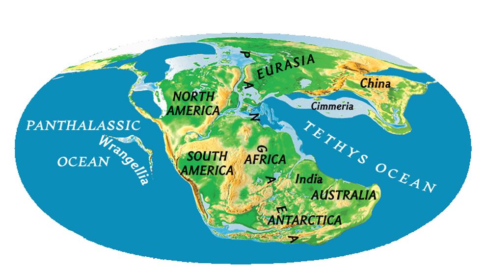
200 million years ago, the earth's continents were connected in a super continent, called Pangea. It was possible for the dinosaurs to walk between what is now Africa, North America, and Antarctica. Then, 100 million years ago, Pangea broke apart. The oceans began flowing between the continents, and mountains and other landforms were created as the continents collided and moved. Areas that were once connected and shared similar landscapes were now separated by mountain ranges and kilometres of ocean.
|
|
|
|
Geo journal entry #1 due Monday Nov. 13th!
Lesson 3: Types of LandForms
|
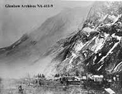
"The Frank Slide was a rockslide that buried part of the mining town of Frank, Northwest Territories, Canada, on the morning of April 29, 1903. It occurred at 4:10 am, when over 82 million tonnes (90 million tons) of limestone rock slid down Turtle Mountain within 100 seconds, obliterating the eastern edge of Frank, the Canadian Pacific Railway line and the coal mine. It was one of the largest landslides in Canadian history and remains the deadliest, as between 70 and 90 of the town's residents were killed, most of whom remain buried. Multiple factors led to the slide. Turtle Mountain's formation left it in a constant state of instability, leading area Native tribes to call it, "the mountain that moves". Coal mining operations may have weakened the mountain's internal structure, as did a wet winter and cold snap on the night of the slide."
Text taken from: www.wikipedia.org |
Types of landform activity
1) Choose one landform that you will all be researching, from the list below:
3) Using the information you hear and read, complete your Graphic Organizer [reading and geography mark]
4) When you are done, you will hand in your "Types of Landforms" sheet and a Ticket-Out-the-Door.
Ticket out the Door: "What is one interesting thing/ cool fact you learned about landforms?"
- Mountains
- Volcanos
- Waterfalls
- Glaciers
3) Using the information you hear and read, complete your Graphic Organizer [reading and geography mark]
4) When you are done, you will hand in your "Types of Landforms" sheet and a Ticket-Out-the-Door.
Ticket out the Door: "What is one interesting thing/ cool fact you learned about landforms?"
Lesson 4: World landform patterns
|
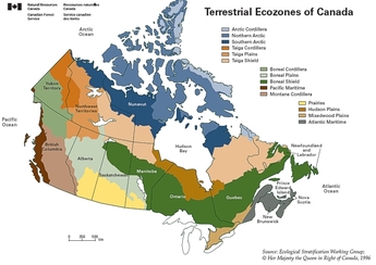
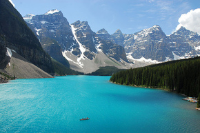
As we've learned, landforms are physical features on Earth. They can be organized into landform regions, which are areas with one main landform region. In Canada, three major landform regions are:
|
How shields are formed
|
Shields are rocky landforms that are created when volcanoes and mountains are worn away.
The Canadian Shield is a massive landform region, covering over half of Canada. The Canadian Shield is too rocky for farming, but it has beautiful scenery and many people go to the region to vacation and enjoy nature. |
How Fold Mountains are formed
|
Fold Mountains are formed when tectonic plates collide and the plates are squeezed together, bending the rock upwards.
The Rocky Mountains are great examples of Fold Mountains. They were formed millions of years ago (which is young for a mountain!) when the Pacific plate collided with the North American plate. Over the years, mountains are eroded to look more like rolling hills. Right now, the Rockies are sharp and steep, and wonderful for skiing and hiking, although they can be dangerous for humans because of avalanches and rockslides. |
How Plains and Lowlands are Formed
|
Plains are flat landform regions that are found around the edges of shield regions. Plains found along a coastal region are called lowlands.
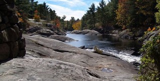
The Great Lakes- St. Lawrence Lowlands (where we live) are great for farming. Farther north, there are the Hudson Bay Lowlands and the Arctic Lowlands, neither of which are good for agriculture. These lowlands are marshy or tundra, and not many people live there. |
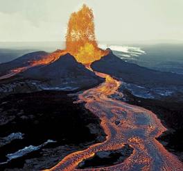
How Volcanos are Formed
|
Volcanos are well-known landforms, thanks to their fiery eruptions of molten rock and lava. Volcanos are formed when molten magma from the mantle layer of the earth breaks through a crack in the crust. When two plates collide, the ocean plate is dragged beneath the continental plate, and the end of the plate as it is pulled down into the hot mantle. Pressure from below pushes the magma upwards, causing the volcano to grow taller and taller.
Two types of volcanos are composite cones (made up of layers of cinders and magma) and shield cones (made up of magma). Volcanos are usually found around the edges of plates. The Pacific Ring of Fire are a circular pattern of active volcanos found along the Pacific ocean, in Japan, Indonesia, and the Phillipines. |
GEO JOURNAL #2: due Friday, Nov 18. 2016
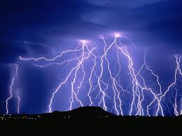
Lesson 5: Natural Phenomena
|
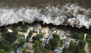
|
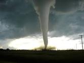
|
Geo Journal #3: Due Week of Nov. 21- 24
Current News: Earthquake in nepal
What causes an earthquake?
http://news.nationalgeographic.com/news/2014/01/140115-earthquakes-california-faults-science/
http://news.nationalgeographic.com/news/2014/01/140115-earthquakes-california-faults-science/
| Nepal Article |
